Category:Ashby Parva
Jump to navigation
Jump to search
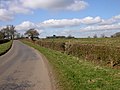
English: Ashby Parva is a village and civil parish in the Harborough district of Leicestershire, England. The parish had a population of 211 according to the 2001 census. The village is in the west of the district, west of the M1 motorway, and nearby Ullesthorpe, Leire and Bitteswell. It is about 3 miles away from Lutterworth. The village was recorded in the Domesday Book.
village and civil parish in Leicestershire, United Kingdom  | |||||
| Upload media | |||||
| Instance of | |||||
|---|---|---|---|---|---|
| Location | Harborough, Leicestershire, East Midlands, England | ||||
| Population |
| ||||
| Area |
| ||||
 | |||||
Subcategories
This category has the following 2 subcategories, out of 2 total.
H
- The Holly Bush, Ashby Parva (1 F)
P
- St Peter's Church, Ashby Parva (15 F)
Media in category "Ashby Parva"
The following 77 files are in this category, out of 77 total.
-
 Ashby Lane south of Ashby Parva - geograph.org.uk - 3447628.jpg 3,752 × 2,589; 3.57 MB
-
 Ashby Parva - Cauldwell Farm - geograph.org.uk - 60925.jpg 640 × 480; 90 KB
-
 Ashby Parva - geograph.org.uk - 146468.jpg 640 × 480; 86 KB
-
 Ashby Parva - geograph.org.uk - 5371173.jpg 4,128 × 2,322; 3.57 MB
-
 Ashby Parva Road Junction - geograph.org.uk - 4355791.jpg 1,600 × 1,136; 328 KB
-
 Ashby Parva sign along Main Street - geograph.org.uk - 3456712.jpg 3,677 × 2,812; 3.01 MB
-
 Business Park entrance - geograph.org.uk - 5684591.jpg 1,600 × 900; 228 KB
-
 Canaan Farm near Ashby Parva - geograph.org.uk - 3447624.jpg 3,497 × 2,699; 2.79 MB
-
 Daffodils on Ullesthorpe Road - geograph.org.uk - 3447505.jpg 4,000 × 2,814; 3.21 MB
-
 Dunton Bassett-Slip Inn Quarry - geograph.org.uk - 2294518.jpg 640 × 480; 59 KB
-
 Dunton Lane - geograph.org.uk - 3820304.jpg 640 × 480; 116 KB
-
 Dunton Lane near Ashby Parva - geograph.org.uk - 3436292.jpg 3,525 × 2,644; 2.52 MB
-
 Electricity pole along the Jubilee Walk - geograph.org.uk - 1936428.jpg 1,812 × 1,860; 1.21 MB
-
 Entrance to Ashby Parva - geograph.org.uk - 3820292.jpg 640 × 480; 106 KB
-
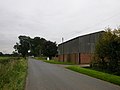
 Farm buildings along Ullesthorpe Road - geograph.org.uk - 3447651.jpg 3,306 × 2,550; 2.56 MB
-
 Farmland next to Frolesworth Road - geograph.org.uk - 2093797.jpg 2,500 × 1,801; 2.25 MB
-
 Farmland north of Ashby Parva - geograph.org.uk - 3436304.jpg 2,917 × 1,897; 1.3 MB
-
 Farmland north of Frolesworth Road - geograph.org.uk - 3447225.jpg 4,000 × 3,000; 3.56 MB
-
 Farmland south of Frolesworth Road - geograph.org.uk - 3447482.jpg 2,601 × 2,302; 1.65 MB
-
 Fields north of Ashby Parva - geograph.org.uk - 3436290.jpg 3,549 × 2,731; 3.15 MB
-
 Fields north west of Dunton Lane - geograph.org.uk - 3820308.jpg 640 × 480; 90 KB
-
 Finger post along Ashby Lane - geograph.org.uk - 3456681.jpg 2,845 × 2,223; 1.97 MB
-
 Footpath round the sand pit - geograph.org.uk - 4078640.jpg 2,048 × 1,536; 885 KB
-
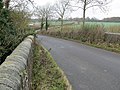 Frolesworth Road bridge - geograph.org.uk - 618533.jpg 640 × 480; 102 KB
-
 Frolesworth Road towards Ashby Parva - geograph.org.uk - 3447210.jpg 4,000 × 3,000; 3.57 MB
-
 Frolesworth Road towards Ashby Parva - geograph.org.uk - 3447485.jpg 3,606 × 2,787; 2.88 MB
-
 Gate and field along Ullesthorpe Road - geograph.org.uk - 3451230.jpg 3,460 × 2,394; 2.84 MB
-
 Gate and hedge along Dunton Lane - geograph.org.uk - 3436305.jpg 3,832 × 2,808; 3.51 MB
-
 Grassland - geograph.org.uk - 5371167.jpg 4,128 × 2,322; 4.41 MB
-
 Heading north along Ashby Lane - geograph.org.uk - 3456673.jpg 2,574 × 1,829; 1.36 MB
-
 Heading west along Frolesworth Road - geograph.org.uk - 3447477.jpg 3,543 × 2,791; 3.03 MB
-
 Leire Lane near Parva Paddocks - geograph.org.uk - 3447130.jpg 3,318 × 2,419; 2.47 MB
-
 Looking towards Ashby Parva - geograph.org.uk - 5685108.jpg 1,600 × 900; 271 KB
-
 Mere Barn along Ullesthorpe Road - geograph.org.uk - 3447644.jpg 4,000 × 3,000; 5.01 MB
-
 Mere Lane - geograph.org.uk - 4956174.jpg 1,280 × 853; 605 KB
-
 Mere Lane - geograph.org.uk - 5684593.jpg 1,600 × 900; 196 KB
-
 North along Ullesthorpe Road - geograph.org.uk - 3447647.jpg 4,000 × 3,000; 3.42 MB
-
 Northeast along Jubilee Walk - geograph.org.uk - 1936427.jpg 2,122 × 1,879; 1.72 MB
-
 Northeast along Jubilee Walk - geograph.org.uk - 2093799.jpg 2,565 × 1,918; 2.05 MB
-
 Oil seed rape field north of Jubilee Walk - geograph.org.uk - 1936425.jpg 3,048 × 2,077; 2.72 MB
-
 Public footpath - geograph.org.uk - 5684596.jpg 1,600 × 900; 542 KB
-
 Rusting farm building along Frolesworth Road - geograph.org.uk - 3447480.jpg 3,284 × 2,427; 2.24 MB
-
 Sheep and creep feeder near Ashby Parva - geograph.org.uk - 3456704.jpg 3,137 × 2,220; 2.27 MB
-
 Sheep and pasture near Ashby Lane - geograph.org.uk - 3456641.jpg 3,246 × 2,156; 1.94 MB
-
 Sheep and pasture near Ashby Lane - geograph.org.uk - 3456661.jpg 1,998 × 1,382; 926 KB
-
 Sheep and pasture near Ashby Parva - geograph.org.uk - 3447597.jpg 4,000 × 3,000; 3.53 MB
-
 Slip Inn Quarry - geograph.org.uk - 3436314.jpg 3,614 × 2,764; 3.1 MB
-
 Slip Inn Quarry - geograph.org.uk - 3436315.jpg 3,065 × 2,160; 2.31 MB
-
 Small wood along Ullesthorpe Road - geograph.org.uk - 3451239.jpg 2,721 × 2,238; 2.22 MB
-
 The Jubilee Walk near Frolesworth Road - geograph.org.uk - 2093798.jpg 3,026 × 2,145; 2.59 MB
-
 The Main Street in Ashby Parva - geograph.org.uk - 3447171.jpg 3,075 × 2,389; 2.04 MB
-
 Tractor near Breach Barn - geograph.org.uk - 3451211.jpg 2,979 × 1,972; 1.71 MB
-
 Ullesthorpe Road in Ashby Parva - geograph.org.uk - 3447569.jpg 3,334 × 2,792; 2.73 MB
-
 Ullesthorpe Road towards Ashby Parva - geograph.org.uk - 3447640.jpg 3,916 × 2,748; 3.46 MB
-
 View towards Ashby Parva - geograph.org.uk - 720021.jpg 640 × 488; 94 KB
-
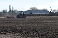
 View towards Low Spinney Wind Farm - geograph.org.uk - 3447632.jpg 2,818 × 2,050; 1.51 MB
-
 View towards Low Spinney Wind Farm - geograph.org.uk - 3456654.jpg 2,209 × 1,584; 989 KB
-
 View towards Low Spinney Wind Farm - geograph.org.uk - 3456696.jpg 2,801 × 2,019; 1.68 MB
-
 Ashby Lane and Main Street junction - geograph.org.uk - 626001.jpg 640 × 428; 72 KB
-
 Ashby Parva - Cauldwell Lane - geograph.org.uk - 146472.jpg 640 × 480; 114 KB
-
 Ashby Parva - geograph.org.uk - 156086.jpg 640 × 480; 89 KB
-
 Ashby Parva - geograph.org.uk - 156525.jpg 640 × 480; 127 KB
-
 Ashby Parva - geograph.org.uk - 156528.jpg 640 × 480; 129 KB
-
 Ashby Parva - geograph.org.uk - 60933.jpg 640 × 480; 103 KB
-
 At the junction for Cotes-de-val - geograph.org.uk - 720131.jpg 640 × 494; 83 KB
-

-
 Cauldwell Lane in Leicestershire - geograph.org.uk - 720086.jpg 481 × 640; 82 KB
-
 Country lane - geograph.org.uk - 626006.jpg 640 × 460; 90 KB
-
 Dunton Lane near Dunton Bassett - geograph.org.uk - 719999.jpg 640 × 476; 113 KB
-
 Dunton Lane, Ashby Parva - geograph.org.uk - 720049.jpg 640 × 417; 79 KB
-
 Farmland and pylons - geograph.org.uk - 720219.jpg 545 × 640; 78 KB
-
 Farmland north of Dunton Lane - geograph.org.uk - 720009.jpg 640 × 506; 75 KB
-
 Frolesworth Road, Leicestershire - geograph.org.uk - 618524.jpg 640 × 522; 79 KB
-
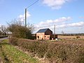
 House in Ashby Parva - geograph.org.uk - 618515.jpg 640 × 460; 57 KB
-
 Leire Lane enters Ashby Parva - geograph.org.uk - 617583.jpg 640 × 428; 96 KB
-
 Rusted and derelict farm buildings - geograph.org.uk - 618529.jpg 640 × 448; 89 KB
-


